


COMPREHENSIVE DIGITAL FARM MAPPING SOLUTIONS
Precision Mapping For Smarter Farm Management
Transform how you manage your property with JAK's Digital Farm Mapping services.
Our Principal Geologist, Kath Kingma, combines geological expertise with precision mapping technology to create detailed, accurate agricultural maps of your farm.
Whether you're planning future development, improving operational efficiency, or need comprehensive property documentation, our tailored mapping solutions provide the clarity and confidence you need.
Detailed Property Documentation
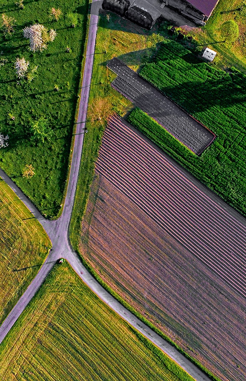
We work one-on-one with property owners to create comprehensive digital maps showing your farm's complete infrastructure, including paddocks, water points, fence lines, access tracks, buildings, and key operational areas.
Precision Planning Tools
Our digital mapping provides accurate spatial information for strategic farm planning, development projects, infrastructure improvements, and operational optimisation across your entire property.
Professional Geological Insight
Benefit from Kath Kingma's geological expertise as we document your property's natural features, topography, and landscape characteristics that impact farm operations and future planning.

OUR FARM MAPPING SERVICES INCLUDE
Complete Infrastructure Mapping
-
Paddock boundaries and livestock areas.
-
Water points, bores, and irrigation systems.
-
Fence lines and gates.
-
Access roads and farm tracks.
-
Buildings, sheds, and operational structures.
-
Drainage and natural waterways.
Flexible Output Options
-
Printable Maps: Custom layouts tailored to your preferred detail level and format.
-
Digital Files: Provided for ongoing property management and future updates.
-
Whiteboard Maps: Printed on whiteboard material for planning meetings and record keeping.
-
Multiple Formats: Various mapping styles to suit different operational needs.
Customised Mapping Solutions
Every map my farm project is tailored to your specific requirements, operational needs, and management style. We work closely wth you to ensure the final maps provide maximum practical value for your property management.

5 BENEFITS OF PROFESSIONAL DIGITAL FARM MAPPING
Enhanced Property Management
Accurate, up-to-date property documentation enables better decision-making for daily operations, seasonal planning, and long-term strategic development.
Professional Documentation
Comprehensive property records support compliance requirements, insurance documentation, succession planning, and property valuations.
Improved Operational Efficiency
Visual property layouts help optimise livestock movement, machinery operations, maintenance schedules, and resource allocation across your farm.
Clear Communication Tool
Professional maps facilitate better communication with contractors, advisors, family members, and stakeholders about property operations and development plans.
Strategic Planning Support
Detailed mapping provides the foundation for expansion planning, infrastructure development, and operational improvements based on accurate spatial information.
THE INDUSTRIES & APPLICATIONS WE SERVE
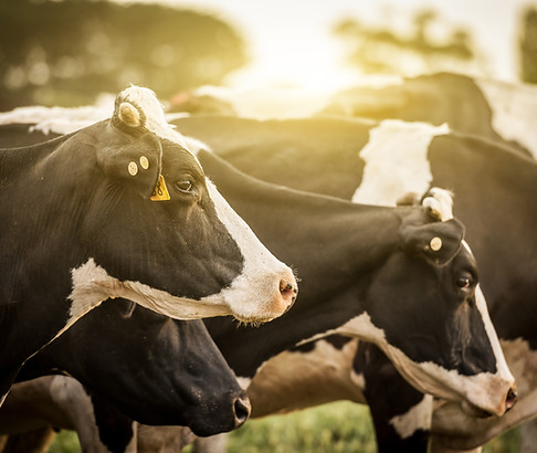
Livestock Operations:
Comprehensive farm paddock mapping for cattle, sheep, and mixed livestock operations including paddock management, water point documentation, and infrastructure planning.
Cropping & Agriculture:
Detailed field mapping for grain production, horticulture, and intensive agriculture including irrigation systems, machinery access, and seasonal planning support.
Mixed Farming Enterprises:
Integrated mapping solutions for diversified agricultural operations combining livestock, cropping, and specialty agricultural activities.
Property Development:
Strategic mapping for agricultural development projects, subdivision planning, and infrastructure expansion supporting growth and operational improvement.
Rural Property Management:
Professional documentation for property management companies, trustees, and agricultural consultants requiring accurate, comprehensive property records.


SOUTHEAST QLD SPECIALISTS WITH NATIONWIDE CAPABILITY
JAK Drilling is based in Gympie, Queensland, ideally positioned to serve Southeast Queensland and surrounding regions with both on-site consultations and comprehensive farm mapping services.
Our digital farm mapping services extend nationwide with flexible delivery options designed to suit your location and project requirements. Using advanced mapping technology and efficient project management processes, we provide accurate, detailed property documentation across Australia's diverse agricultural regions, with particular expertise in Queensland's varied farming environments.
Whether through on-site visits for regional Queensland properties or remote consultation for distant locations, our streamlined approach ensures you receive the same high-quality, personalised service that sets JAK apart.
With extensive experience across Southeast Queensland's farming conditions and broader agricultural regions, we adapt our mapping solutions to local conditions and operational requirements while maintaining clear communication and efficient project delivery throughout the process.
WHY CHOOSE JAK'S FARM MAPPING SERVICES
Geological Expertise Advantage
Kath Kingma's geological background provides unique insight into your property's natural features, soil characteristics, and landscape factors that impact agricultural operations and future planning decisions.
Personal Service & Practical Results
We work one-on-one with property owners to create user-friendly maps designed for real-world farm operations. Clear, practical layouts support daily management and strategic planning with ongoing support available.
Australia-Wide Professional Capability
Our digital farm mapping services are available nationwide with flexible delivery options including remote consultation and on-site visits, ensuring professional results regardless of your property size or location.